
However, the challenge came with the scanned data acquired from flying drones over the desired site. In order to make the scanned data useful, Deas needed to first import the data and then convert it into a CAD model, which could then be delivered to his customers as an accurate site plan and construction drawing.
“I was using DraftSight [by Dassault Systèmes] to capture site layouts for the drainage layouts,” explains Deas. “But in 2D, I wasn’t able to accurately show the lay of the land. Instead, I would have to get a 2D plan from the utility power networks and use it to measure the fall of the ground or soak away depth.”
Deas realised if he could get a 3D topographical scan of the landscape into a CAD model, it would give a much deeper insight into specific landscapes. This makes the design process a lot faster for those involved, as the 3D visualisation of buildings and utilities allows for a more intuitive design and planning experience.
 For Circumspectis to work as a business, Deas needed a CAD package with specific tools including Finite Element Analysis, a CAD library Toolbox, Rendering and a Product Data Management system.
For his new droning venture, Deas uses SolidWorks ScanTo3D solution, which reduces the time required to build complex 3D models of real-world items. By taking 3D scan data, such as point clouds and mesh, SolidWorks ScanTo3D can quickly convert the information into 3D solids and surfaces.
“Traditionally, collecting landscape data is done via a theodolite for surveying sites, which can take many hours, even days to compile, depending on the acreage,” he says. “It’s a lot quicker if you do it from
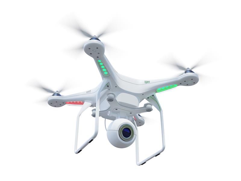
the air. Using a DJI Phantom 3 Drone, I can map a site in 15 minutes with accuracy to the nearest cm. I can mark out the area, set the height at which the drone can fly and work out a pre-set GPS flight plan. The drone does everything automatically and compiles hundreds of photos that can then be converted into accurate site plans.”
Using SolidWorks ScanTo3D, Circumspectis can quickly import the scan data into 3D CAD and apply texture data to the mesh, refine imported mesh and use a Deviation Analysis tool to inspect for any discrepancies.
“With the imported scan data, I can see the contours of the ground and work out exactly where the steel spillages and filtrations systems need to go,” says Deas. “I can then quickly turn the scan into a mesh file and get a perfect 3D solid model, which we can pull into an assembly. It makes designing for agricultural and civil engineering projects a lot easier and faster.
“With SolidWorks, we can quickly convert the 3D scan data into useable surface CAD models. It’s easy to use and our design processes are significantly faster, which means we can spend more time on innovation and discovering new design applications.”
Manipulating drone data into accurate 3D models is now a real solution for architects, environmental agencies and civil engineers needing accurate site layouts.
“Whether you are building a phone mast, telegraph pole, bridges or measuring land erosion, the potential is huge,” says Deas. “Drones are a cost-effective and risk-free way of inspecting buildings or areas that can be too dangerous to enter or access. We recently did a 3D scan near a beach by a clifftop and because each drone mission is set on GPS co-ordinates, we can fly the drone using the same flight data to compare scans over various periods of time to measure how much subsidence or coastal erosion there is.”
Circumspectis is also using the technology to map archaeological digs to model ancient villages and show what they would have looked like to scale.
Powered by Dassault Systèmes’ 3DEXPERIENCE platform, SolidWorks 2018 aims to support all engineering activities from design to manufacture with solutions that simplify the interactions between disciplines across the product development workflow. This unified process leverages smart manufacturing — a connected and seamless flow of data that is available to all teams involved in product development whenever, wherever and in whatever format is needed without having to port data from one system to another. “Lots of designs involve welding plate and sheet metal parts and most people use ‘tab and slot’ techniques for self-fixturing the parts for welding,” says Edson Gebo, owner of Digital Detail & Design. “The new tab and slot feature saves a lot of time versus having to create these features manually. This will really help get designs to the shop faster.” With SolidWorks 2018, teams can collaborate concurrently to more rapidly and cost-efficiently design a product or part, validate its function and manufacturability, manage its data and related processes, streamline and automate its manufacturing, and even inspect it. Any changes in design or manufacturing are fast and easy to manage and automatically flow to all related models, programs, drawings and documentation, thanks to intellectual property embedded early on in the design process. A key feature of SolidWorks 2018 for this process is SolidWorks CAM, a new application that provides rules-based machining with knowledge capture to allow for the automation of manufacturing programming. Designers and engineers can gain a greater understanding of how their designs are made, make more informed decisions, and quickly create prototype parts and manufacture in-house to control quality, cost and delivery. This application also enables teams to execute new ‘build to order’ strategies with custom parts that are automatically designed and programmed in seconds rather than hours. |
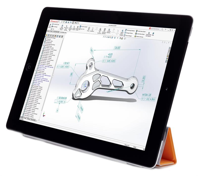 Solidworks 2018 increases Design for Manufacture capability


